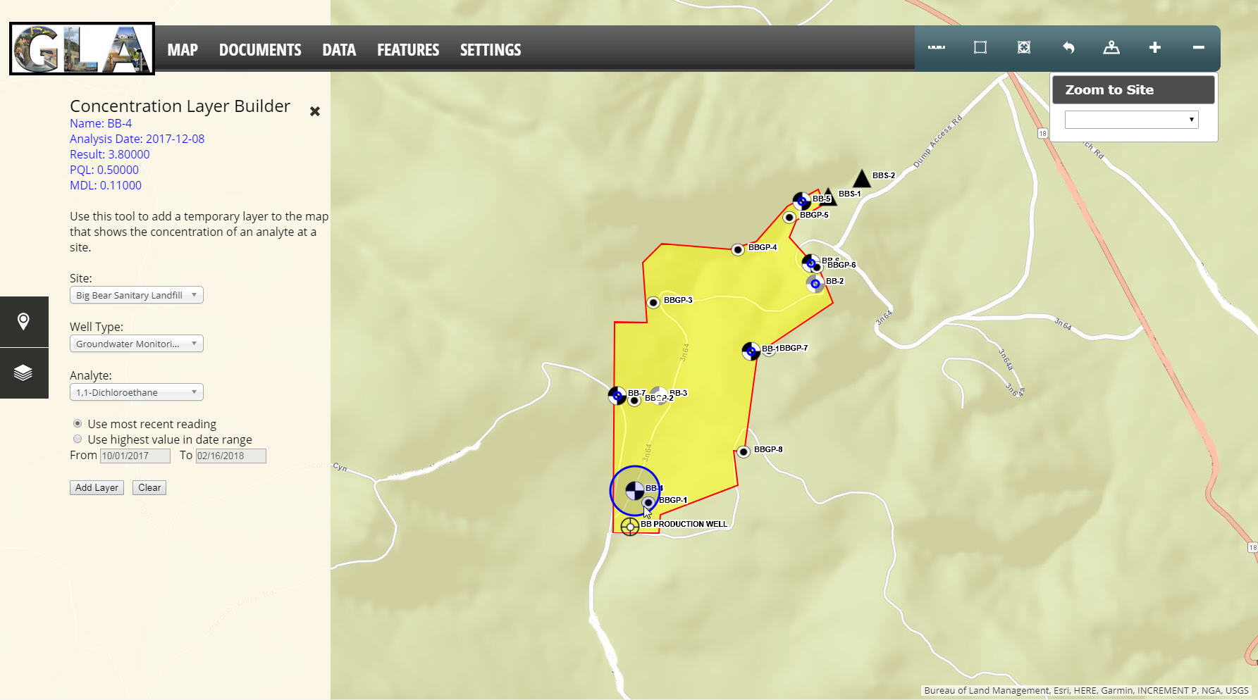
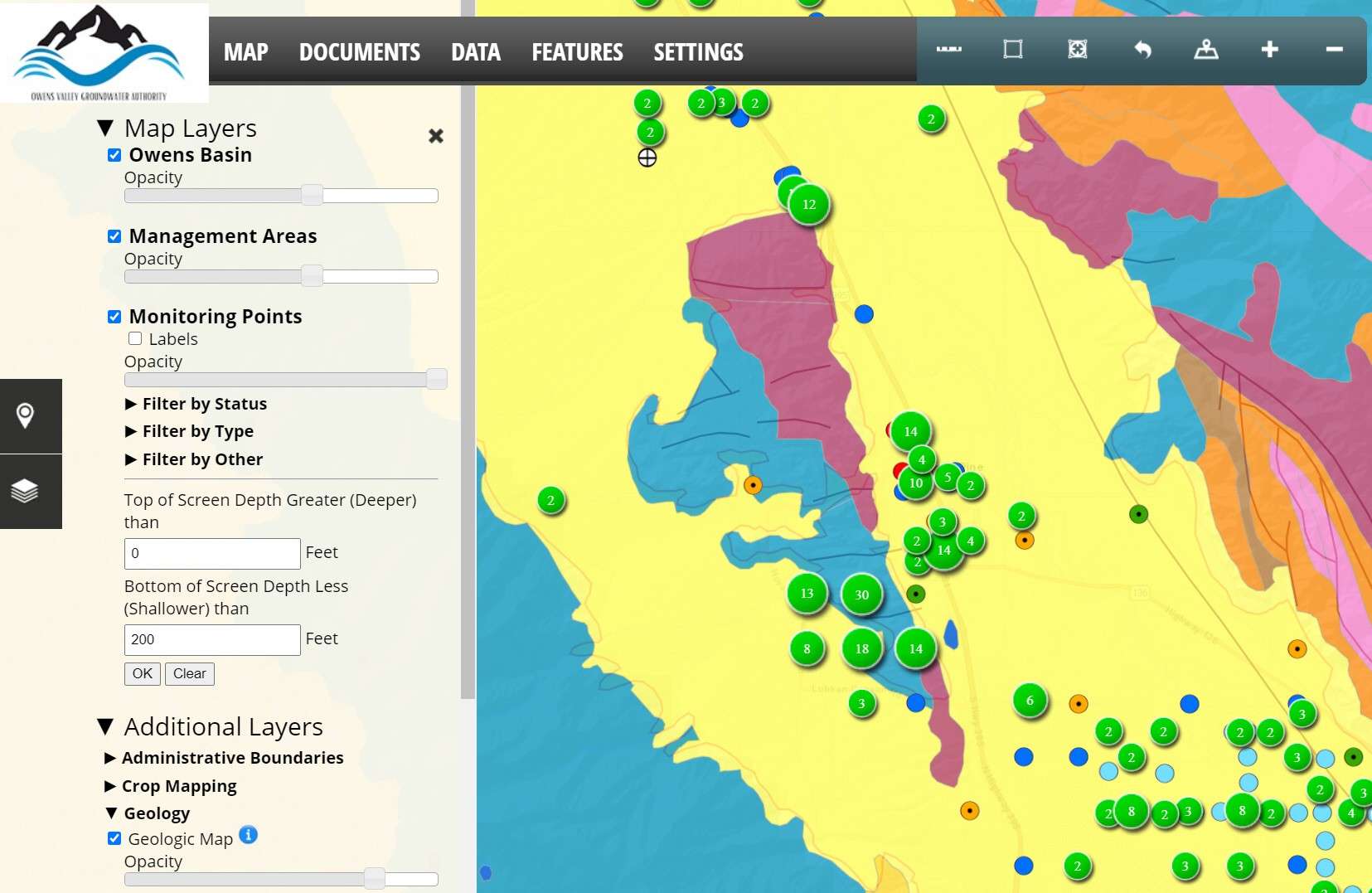
What is GLA-Data?

GLA-Data is a comprehensive, web-accessible, geographic information system (GIS)-based, database management system (DBMS). It was originally developed to manage well data and analyze water quality information and has been continuously enhanced and refined to address client goals over 15 years. Customized versions of GLA-Data currently serve more than 20 clients across the West. GLA-Data provides a user-friendly, streamlined system to manage data related to water supply and groundwater quality.

GLA-Data has been customized for several different water well management priorities:

  • Reporting, compliance, and stakeholder support for Groundwater Sustainability Plans for California Groundwater Sustainability Agencies
  • Well registration, permitting, and reporting for groundwater districts and large landholders
  • Water quality management and reporting for landfills/waste disposal sites
  • Management of data for environmental litigation

GLA-Data utilizes a .NET 4.5 (C#), which is a server-side scripting engine for dynamically-generated webpages from Microsoft. Various built-in objects of the .NET framework are employed when programming a website using .NET, handling HTML rendering internally on the web server, and enabling dynamic webpages to be designed using familiar form controls. The web application and data repository reside either on GLA’s servers, securely behind the GLA System Administration’s firewall, or within a secure Cloud Service, unless our clients choose to host the system.

The following active sites are accessible to the public, for example:

Fillmore and Piru Groundwater Basins GLA-Data site

Owens Valley Groundwater Basin GLA-Data site

Sierra Valley Groundwater Basin GLA-Data site
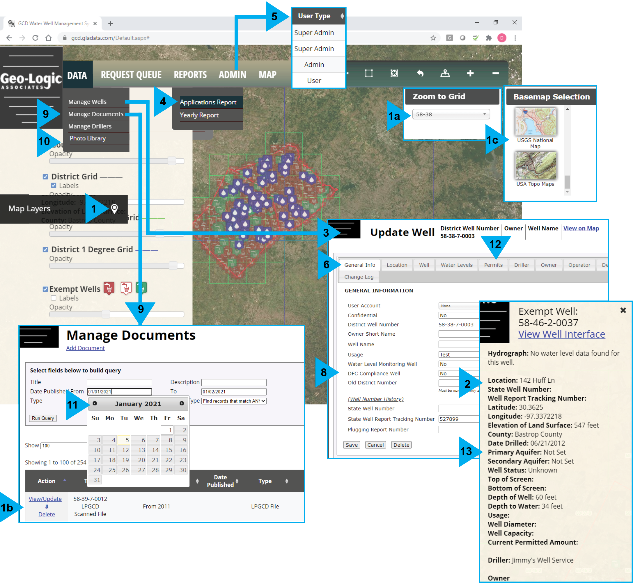
GLA-Data Customizable Features at a Glance

GLA-Data is customizable, user-friendly, widely accessible, and secure.

Customizable Features

  1. GIS map-based front-end, with interactive mapping tools for a) spatial queries, b) exporting and print options, and c) integrating with web services from other partners
  2. Spatial data associated with other parameters
  3. Custom tools and queries to support permitting, monitoring, and reporting to outside agencies to support a variety of efforts, including desired future conditions and modeled available groundwater
  4. Custom reports
  5. Multi-level access interface
  6. Data import/collection using online forms
  7. Data import and export options compatible with third-party systems (e.g., application programming interfaces)
  8. Customizable query interface for ratings, reports, permits, and letters
  9. Document library
  10. Photo library
  11. Calendars
  12. Permit renewals
  13. Aquifer features and stratigraphy of point location

USER-FRIENDLY FEATURES

  • GIS map-based interface
  • Web-accessible and searchable database management system
  • Remote data entry from a computer, tablet, or mobile device
  • Data collection and import using online forms and documentation
  • Custom tools and queries for permitting, monitoring, and reporting to outside entities
  • Simple data output, reporting, and graphing functions

ACCESSIBILITY FEATURES

  • The same information can be accessed by every user simultaneously or individually using most web browsers, including Mozilla Firefox or Chrome, from either desktop computers or mobile devices
  • No additional software required for personal computers or individual work stations

SECURITY FEATURES

  • Functionality can be limited or restricted for multi-user-level access with login access to sensitive data that is password-protected
  • Data manipulation; quality assessment/quality control of water well data; viewing and editing user accounts can be managed by internal users

26 OFFICE LOCATIONS, 1 HIGHLY EXPERIENCED TEAM