–
We’re heading to the 76th Annual Meeting of the Geological Society of America (GSA) Rocky Mountain Section, taking place May 18 to 20, 2026, in Albuquerque, New Mexico—where cutting-edge science meets the dynamic geology of the Southwest.
This year’s meeting brings together leading geoscientists, engineers, and industry professionals to explore complex subsurface systems—from rift basins and volcanic terrains to sedimentary environments shaping today’s resource and water challenges. Technical sessions will provide a platform for advancing real-world applications across hydrogeology, engineering geology, and resource management. Attendees will gain a valuable perspective on the geologic processes shaping the American West and beyond.
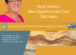
GLA Hydrogeologist Ethan Williams will present “It’s Getting Hot Outside, Will New Mexico’s Groundwater Help Us Meet Future Water Demands?” Co-authored by GLA geoscientists Christopher Wolf, PG, and Katherine Graves, and Sean D. Connell from New Mexico Institute of Mining and Technology, and Seogi Kang from the University of Manitoba, the presentation will be part of the “Integrating Geophysics, Data Systems, and Modeling for Aquifer Characterization in Data-Sparse Regions” session.
Abstract
Over the next 50 years, New Mexico’s arid climate is expected to heat up altering historical weather patterns. Climate models indicate that as temperatures increase, the timing and intensity of our precipitation will change ultimately decreasing our surface water supplies. So, our reliance on groundwater will certainly increase, but what resources are available?
To identify and plan for our future water demands, New Mexico has adopted a 50-Year Water Action Plan to improve our water resource management and identify available resources. Across New Mexico, our goal is to characterize fresh and brackish groundwater resources in more than 30 groundwater aquifers and basins by 2037.
To understand these aquifers, airborne geophysical surveys and existing geologic knowledge are being used to create 3D geologic models. Airborne geophysical surveys are a powerful means of collecting data on geology and water resources at the basin scale, providing insight into the subsurface at a high resolution to depths of hundreds of meters. 3D models developed in part with these new geophysical datasets will be the framework for numerical groundwater modeling of the fresh and brackish resources to help us understand the availability, quantity and quality of groundwater in New Mexico.
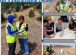
We are currently working on the Estancia Basin in central New Mexico and the Animas, Playas, and Lordsburg Basins in Southwest New Mexico’s Bootheel. Geotech Ltd. of Ontario, Canada, has completed the airborne geophysical surveys using their Versatile Time Domain Electromagnetic (VTEM™) instrumentation that’s mounted on a helicopter. Flight lines included about 2,690 kilometers (km) in the Estancia Basina and 2,020 km in the bootheel basins with a depth of investigation of about 300 meters.
When creating the 3D models, we integrated the geophysical data with existing geologic maps and cross-sections to extend the modeled depths to about 1,200 meters below ground surface. For the geologic structures and stratigraphy, we relied on well logs, geophysics, water chemistry, and the geologic literature. The geologic model is being used to identify data gaps particularly related to brackish aquifers. Future efforts will fill-in these data gaps by drilling wells into target aquifers to collect geological, geophysical, hydrological, and geochemical data.